
| Home |
|
|
|
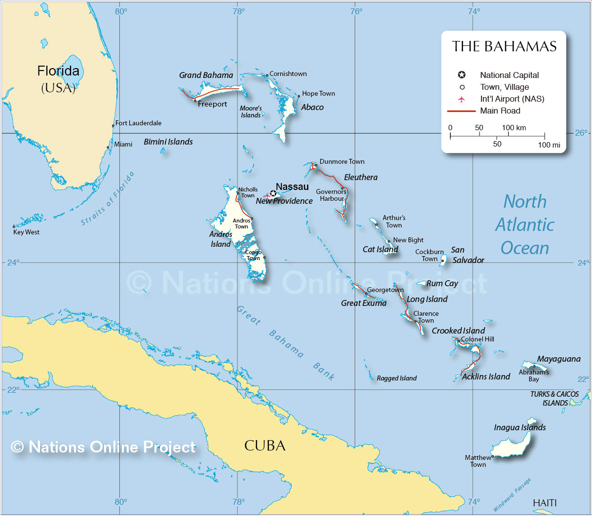
___ Political Map of the Commonwealth of The Bahamas |
|
About The Bahamas |
|
| The Bahamas is a country in the northwestern West Indies, located 80 km (50 mi) south-east of the coast of Florida (USA) and north of Cuba. The Caribbean islands
group consists of around 700 islands and islets, and more than 2,000 cays (coral reefs). Only about 30 islands are
inhabited. The Bahamas has become one of the world's foremost vacation resorts. Nassau, on the island of New Providence is the political capital and the commercial hub of the archipelago. Bimini is the westernmost island of the Bahamas, situated about 80 km (53 mi) east of Miami, Florida, making it the closest point in the Bahamas to the US mainland. Lynden Pindling International Airport (IATA Code: NAS) formerly known as Nassau International Airport, is the largest airport in the Bahamas, and the primary international gateway into the country. The airport is located about 16 kilometers (10 mi) west of Nassau City. The Bahamas share maritime borders with: Cuba, Haiti, the United States, and Turks and Caicos Islands (UK). Map is showing the islands of The Bahamas with the national capital Nassau, major towns, and main roads. |
 Bookmark/share this page |
 One World - Nations Online countries of the world |
|
|
||
 Map of The Bahamas |
|||||||
| Major islands of the Bahamas: Abaco, Acklins, Andros Island, Cat Island, Crooked Island, Eleuthera, Exuma, Grand Bahama, Inagua, Long Island, Mayaguana, New Providence, and San Salvador Island. |
More about The Bahamas Cities: Country: Continent: |
Nassau Current Weather Conditions
|
Related Consumer Information: |
||||
One World - Nations Online .:. let's care for this planet Every nation is responsible for the current state of our world. |
| Site Map
| Information Sources | Disclaimer: Privacy Policy, etc. Contact: [email protected] | Copyright © 1998-2021 :: nationsonline.org |
