Nations Online
All Countries in the World
Nations Online All Countries in the World | |
Home  |
___ Satellite View and Map of the City of Caracas, Venezuela |
About Caracas Satellite view is showing Caracas, by far the largest urban agglomeration in the country and the national capital of Satellite view is showing Caracas, by far the largest urban agglomeration in the country and the national capital of The city is located in central north of the country, about 13 km (8 mi) inland south of the mountains of the Venezuelan coastal range (Cordillera de la Costa) that separates the city from the Caribbean Sea. Metropolitan Caracas includes the Distrito Capital (the capital city proper) and four other municipalities in Miranda State: Baruta, Chacao, El Hatillo, and Sucre (not to be confused with Bolivia's constitutional capital Sucre). Caracas lies in a tropical climate zone with average temperatures of over 23° Celsius year-round. The city has an urban population of almost 6 million people. Official language is Spanish. The city is the seat of the federal government (in Capital District), it is home to Venezuela's stock exchange, and the country's leading university, the Central University of Venezuela. Just zoom in to see Palacio de Miraflores, the official working residence of Venezuela's President. The map shows a city map of Caracas with expressways, main roads and streets, zoom out to find the location of Simón Bolívar International Airport (IATA code: CCS), 40 km (25 mi) by road (via Autopista Caracas - La Guaira) northwest of downtown Caracas. To find a location use the form below. |
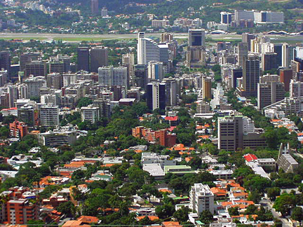 East area of Caracas, Chacao municipality and the area of Francisco de Miranda Airport in background (the airport is since 2005 closed to public use). - Image: Kinori 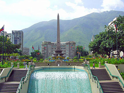 Plaza Francia Plaza Francia |
| To find a location type: street or place, city, optional: state, country. |
Local Time Venezuela:
Thursday-April-18 23:10
Standard time zone: Venezuelan Standard Time UTC/GMT -4:30 hoursVenezuela changed its time zone from UTC -4h to UTC -4:30h on 1 September 2007. |
|
φ Latitude, λ Longitude (of Map center; move the map to see coordinates): , |
||||||
| Google Earth: Searchable Map and Satellite view of Caracas, Venezuela. City Coordinates: 10°30′N 66°55′W |
Bookmark/share this page |
|||||
| More about Venezuela: Country: Continent: External Links: Caracas (official website) Wikipedia: Caracas |
Weather Conditions Caracas:
|
Related Consumer Information:
|
||||
| Other Cities in South America: Asunción (Paraguay) - Bogotá D.C. (Colombia) - Brasilia, Rio de Janeiro, São Paulo, Salvador, (all Brazil) - Buenos Aires (Argentina) - Cayenne and Kourou (both French Guiana) - Georgetown (Guyana) - La Paz, Sucre (both Bolivia) Lima (Peru) - Montevideo (Uruguay) - Paramaribo (Suriname) - Port of Spain (Trinidad and Tobago) Quito (Ecuador) - Santiago (Chile) |
Map Help [ show ] |
One World - Nations Online .:. let's care for this planet Promote that every nation assumes responsibility for our world. Nations Online Project is made to improve cross-cultural understanding and global awareness. More signal - less NOISE |
| Site Map
| Information Sources | Disclaimer | Copyright © 1998-2023 :: nationsonline.org |

