Nations Online
All Countries in the World
Nations Online All Countries in the World | |
Home  |
___ Satellite View and Map of the City of Nouméa, New Caledonia |
Searchable Map and Satellite View of Noumea using Google Earth Data
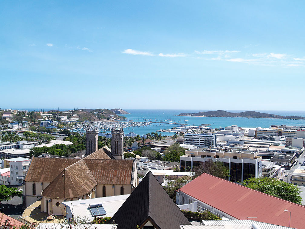 Nouméa city center and with the Roman Catholic Nouméa Cathedral. Image: Thomas@RUN Greater Nouméa has a population of more than 100,000 inhabitants. Official language is French. The map shows a city map of Nouméa with expressways, main roads and streets, the location of Nouméa Magenta Airport (IATA code: GEA), zoom out to find La Tontouta International Airport (IATA code: NOU) located about 50 km (31 mi) northwest of the city. To find a location use the form below. |
|
| To find a location type: street or place, city, optional: state, country. |
Local Time New Caledonia:
Tuesday-April-16 22:26
Time zone: New Caledonia Time (NCT) :: UTC/GMT +11 hours |
|
φ Latitude, λ Longitude (of Map center; move the map to see coordinates): , |
||||||
| Google Earth: Searchable Map and Satellite view of Nouméa, New Caledonia. |
Bookmark/share this page |
|||||
| More about New Caledonia: Country: Continent: External Links Nouméa (official website) Wikipedia: Nouméa |
Weather Conditions New Caledonia:
|
Related Consumer Information:
|
||||
Other Melanesian Island Nations and Territories: Fiji, Papua New Guinea, Solomon Islands, Vanuatu |
||||||
Map Help [ show ] |
||||||
One World - Nations Online .:. let's care for this planet Promote that every nation assumes responsibility for our world. Nations Online Project is made to improve cross-cultural understanding and global awareness. More signal - less NOISE |
| Site Map
| Information Sources | Disclaimer | Copyright © 1998-2023 :: nationsonline.org |

