Nations Online
All Countries in the World
Nations Online All Countries in the World | |
Home  |
___ Famous Landmarks: Sacred Mountains - Satellite View and Map of Mount Vesuvius (Ital.: Monte Vesuvio) |
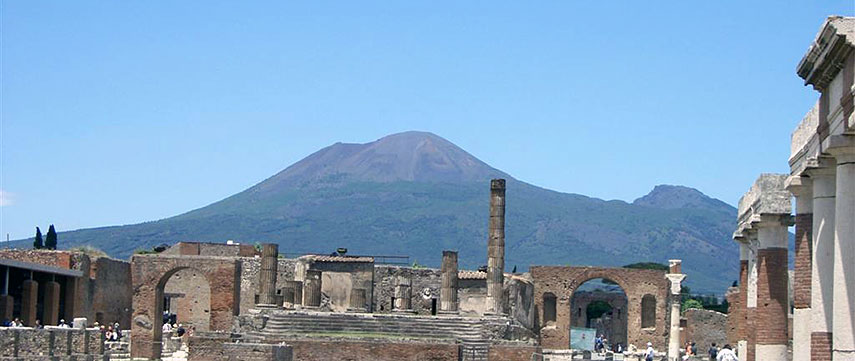 Ruins of Pompeii, the ancient Roman city and many villas in the area were mostly destroyed and buried under 4 to 6 m of ash and pumice (a volcanic rock) in the eruption of Mount Vesuvius in 79 AD. Image: James Harrold |
About Mount VesuviusSatellite view is showing Mount Vesuvius in the Campania region of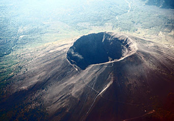 Vesuvius seen from plane. Image: Pastorius 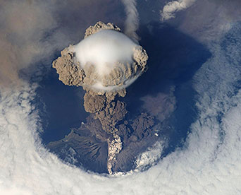 A Plinian eruption seen from space. Image: NASA In the year 79 AD on 24 August, one day after the annual Vulcanalia festival in honor of Vulcan, the god of beneficial and hindering fire, Mount Vesuvius changed history with a highly explosive eruption, sending for two days rocks, dust, gas and pyroclastic material into the stratosphere at rate of thousands of tones per second, followed by voluminous lava flows, and volcanic ash rain. The debris buried the ancient Roman cities of Pompeii, Herculaneum, and Stabiae and led to the death of estimated 10,000 to 25,000 people. The region around Naples is an area of highly volcanic activity, beside Vesuvius there are the Phlegraean Fields, a large volcanic area situated to the west of Naples. The Fields include the Naples districts of Agnano and Fuorigrotta, the area of Pozzuoli, Bacoli, Monte di Procida, Quarto, and the Phlegrean Islands of Ischia, Procida and Vivara. Zoom out to see the location of the volcanic islands of Ischia and Procida, and the island of Capri. |
|
| To find a location type: street or place, city, optional: state, country. |
Local Time Naples:
Friday-April-19 10:27
Standard Time Zone (CET): UTC/GMT +1 hourCEST (Daylight Saving Time) in use from end of March until end of October: time zone offset: UTC/GMT +2 hours |
One World - Nations Online .:. let's care for this planet Promote that every nation assumes responsibility for our world. Nations Online Project is made to improve cross-cultural understanding and global awareness. More signal - less NOISE |
| Site Map
| Information Sources | Disclaimer | Copyright © 1998-2023 :: nationsonline.org |

