Nations Online
All Countries in the World
Nations Online All Countries in the World | |
Home  |
___ Satellite View and Map of Venezuela |
 The flat-topped Mount Roraima, (Cerro Roraima) it is with 2,810 m the highest mountain in the Pakaraima chain in the Guiana Highlands, located at the triple border point of Venezuela, Brazil and Guyana in South America. - Image: Paolo Costa |
About Venezuela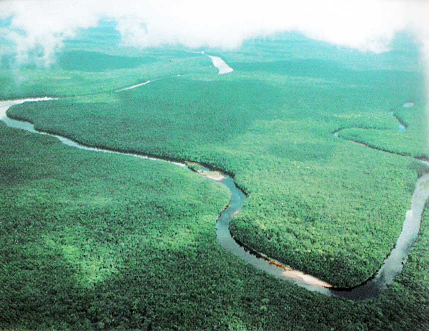 Orinoco Delta in eastern Venezuela. - Image: Milito Venezuela occupies an area of 912,000 km² , that is slightly more than twice the size of Sweden or slightly more than twice the size of the U.S. state of California. Venezuela has a population of 31.1 million inhabitants (in 2015). Capital and largest city is Caracas. Official language is Spanish. The map shows Venezuela with cities, towns, expressways, main roads and streets. To find a location use the form below. |
|
| To find a location type: street or place, city, optional: state, country. |
Local Time Venezuela:
Thursday-April-25 18:40
Standard time zone: Venezuelan Standard Time (VET) UTC/GMT -4:30 hours. Venezuela changed its time zone
from UTC -4h to UTC -4:30h on 1 September 2007. |
|
φ Latitude, λ Longitude (of Map center; move the map to see coordinates): , |
||||||
| Google Maps: Searchable Map of Venezuela. Points of interest: Old town of Caracas with the National Pantheon of Venezuela, Plaza Bolívar, and Altamira. Margarita Island with Playa El Agua, Playa El Yaque (beach), Mochima National Park, Morrocoy National Park, Llovizna Falls, Pico Naiguatá, Jesús Soto Museum of Modern Art in Ciudad Bolívar. |
Bookmark/share this page |
|||||
| More about Venezuela: Cities: Country: Continent: |
Weather Conditions Caracas: Weather station is at Simón Bolívar International Airport
|
Related Consumer Information:
|
||||
| Searchable Maps of other Countries in South America: Argentina, Brazil, Bolivia, Chile, Colombia, Ecuador, French Guiana Guyana, Paraguay, Peru, Suriname, Uruguay, Venezuela Maps of other Countries in South America: Argentina Map, Brazil Map, Bolivia Map, Chile Map, Colombia Map, Ecuador Map, French Guiana Map, Guyana Map, Paraguay Map, Peru Map, Suriname Map, Uruguay Map, Venezuela Map Countries and Territories of The Americas |
||||||
Map Help [ show ] |
||||||
One World - Nations Online .:. let's care for this planet Promote that every nation assumes responsibility for our world. Nations Online Project is made to improve cross-cultural understanding and global awareness. More signal - less NOISE |
| Site Map
| Information Sources | Disclaimer | Copyright © 1998-2023 :: nationsonline.org |

