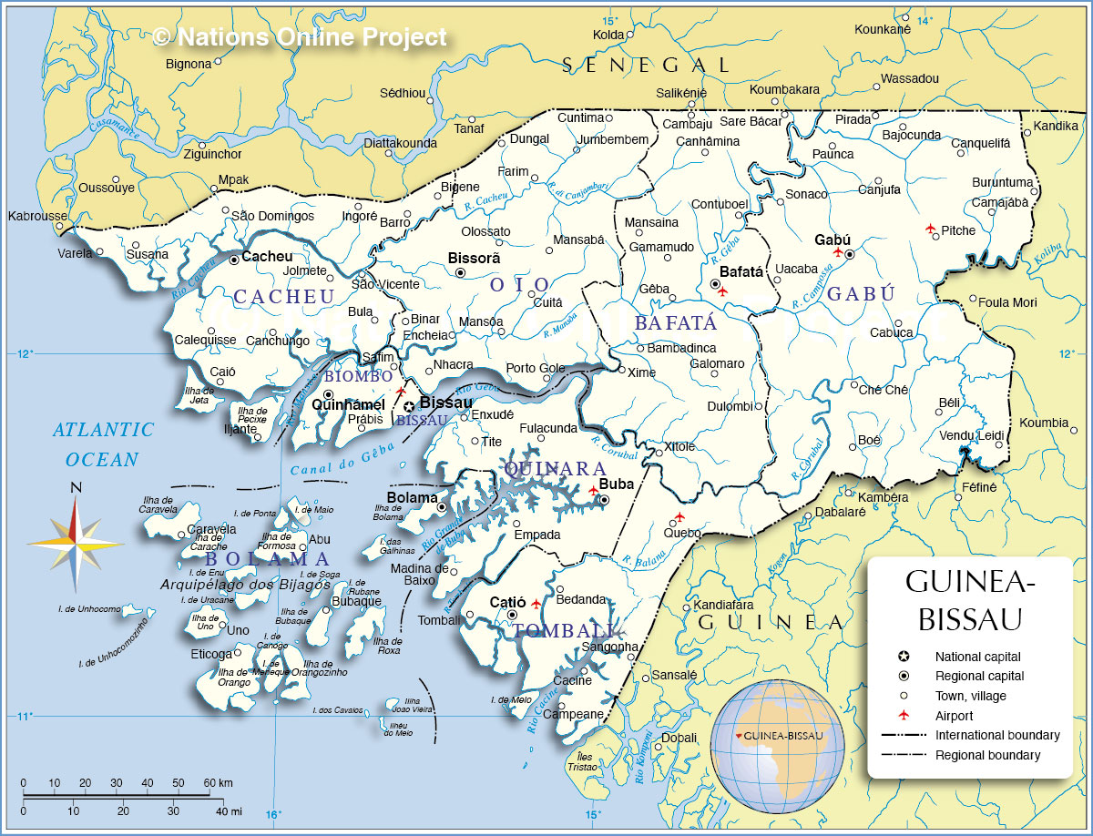
___ Administrative Map of Guinea-Bissau
Map is showing Guinea-Bissau and the surrounding countries with international borders, provinces boundaries, the national capital Bissau, provinces capitals, major cities, and airports.
Border Countries: Guinea, Senegal
Administrative Regions of Guinea-Bissau
Guinea-Bissau is divided in eight regions and one autonomous sector,the regions are (regional capitals in parentheses):
Bafata (Bafata), Biombo (Quinhámel), Bolama (Bolama), Cacheu (Cacheu), Gabú, (Gabú), Oio (Bissorã), Quinara (Buba), Tombali (Catió), and Bissau Region (autonomous sector)

One World - Nations Online
countries of the world