Advertising

Puerto Rico Flag detail

Map of Puerto Rico


Mar Chiquita Beach, Puerto Rico
View of the Mar Chiquita Beach, near Manatí, in the central north of Puerto Rico.
Image: risingthermals

Puerto Rico Flag
Puerto Rico Flag


About Puerto Rico

Feature Details
Official Name Commonwealth of Puerto Rico
Status Unincorporated U.S. Territory
Capital San Juan
Official Languages Spanish, English
Area 9,104 km² (3,515 sq mi)
Highest Point Cerro de Punta (1,338 m / 4,390 ft)
Main Islands Puerto Rico, Vieques, Culebra, Mona
Currency United States Dollar (USD)
Time Zone Atlantic Standard Time (UTC−4)
The Commonwealth of Puerto Rico (Spanish: "Estado Libre Asociado de Puerto Rico") is an island group in the Greater Antilles between the North Atlantic Ocean and the Caribbean Sea, east of the island of Hispaniola, (which is shared by Haiti and the Dominican Republic).


Puerto Rico occupies an area of 9,104 km² (3,515 sq mi), compared; it is about the size of Cyprus or approximately two-thirds the size of the US state of Connecticut.

The island has a population of 3.18 million (in 2025), capital and largest city is San Juan. Spoken languages are Spanish and English. Ethnic groups of Puerto Rico are about 50% Mixed, 17% White, and 7% Black (2020).

Puerto Rico Map


Reference Map of Puerto Rico
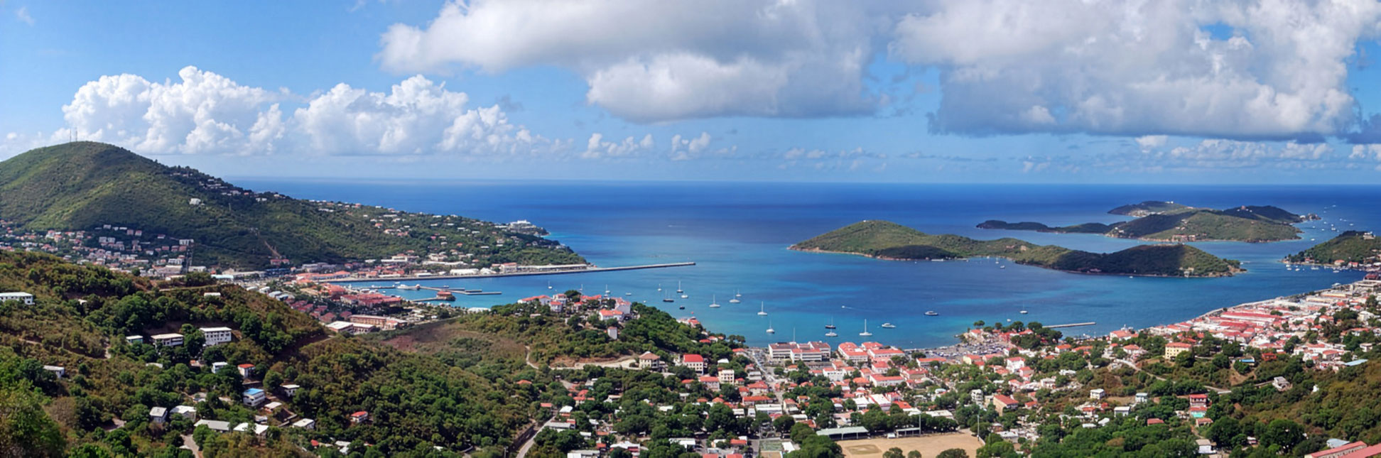
General Map of Puerto Rico and the Virgin Islands.

The detailed map shows Puerto Rico and the Virgin Islands, the location of the diverse capitals, major cities and populated places, rivers and lakes, main roads, major airports, and the topography and bathymetry.

You are free to use the above map for educational and non-profit purposes; if you publish it online or in print, you need to credit the Nations Online Project as the source.


More about Puerto Rico


Short History


Governor's Palace and the sea wall in San Juan
Governor's Palace and the sea wall in San Juan in 1903.
Image: Detroit Publishing

Puerto Rico is among the earliest Spanish footholds in the Americas. After the Spanish-American War, Spain ceded the island to the United States in 1898.
In 1952, Puerto Rico became a self-governing commonwealth in voluntary association with the United States, exercising full authority over its internal affairs while remaining under U.S. sovereignty.


Puerto Rico's Geographical Features


Puerto Rico is a group of tropical, mountainous islands in the Caribbean. More than 60% of the main island's surface area is mountainous. It features a central mountain range, known as the Cordillera Central; the range is home to the highest peak, the Cerro de Punta, at 1,338 meters (4,393 ft).
Other, smaller ranges are, the Sierra de Luquillo in the east and the Sierra de Cayey in the southeast.
The mountains are the source of dozens of short, fast-flowing rivers that radiate toward the coast.

The island's wetlands, mangrove lagoons, and coastal estuaries form important transition zones between the land and the sea.

In addition to the main island, the Commonwealth of Puerto Rico has two larger offshore islands, Vieques and Culebra, and over 140 small islands, reefs, and islets.
The archipelago is of volcanic origin but feature extensive karst terrain due to thick marine limestone deposits.


Cordillera Central of Puerto Rico In the Cordillera Central of Puerto Rico. View from the Mirador (lookout) Villalba-Orocovis.
Image: Ratzer


Nature


El Yunque rainforest
The El Yunque rainforest is the only tropical rainforest in the U.S. National Forest System; it is known for heavy rainfall and high biodiversity.

Toro Negro State Forest
The Bosque Estatal de Toro Negro is Puerto Rico's highest cloud forest, situated in the Cordillera Central region.


Rivers of Puerto Rico


Puerto Rico has short by nature, non-navigable rivers, which primarily flow from the central mountains to the north and west coasts.

Río de la Plata
At 74 km (46 miles), the Río de la Plata is the longest river on the island; it flows into the sea on the north coast.

Río Grande de Loíza
The Río Grande de Loíza is the largest by volume; it flows through the northeast and empties into the North Atlantic Ocean.

El Yunque National Park A stream in El Yunque National Park, the forest is the only tropical rainforest in the U.S. Forest Service system.[DPR]
Image: DJDouken

Río Grande de Añasco
The Río Grande de Añasco is a significant river on the west coast. Its source is in the Cordillera Central and its mouth is on the Mona Passage.

Río Grande de Arecibo

Río Grande de Arecibo is a major river on the north coast. Its mouth is at Arecibo Bay.

Río Culebrinas
The Río Culebrinas flows to the west coast and empties into the Mona Passage.

Río Camuy
Río Camuy is known for its large underground section forming the Camuy River


Lakes
Puerto Rico's lakes are all reservoirs built on rivers, those lakes are known as embalses.


Guajataca Lake
Guajataca Lake is the largest freshwater lake (reservoir) in Puerto Rico, boasting a capacity of 11 billion gallons.

Dos Bocas Lake
The Dos Bocas Lake is a reservoir of the Arecibo River; it is famous for its boat tours, scenic views, and restaurants along the shore.


Other major man-made reservoirs serving as key water sources and recreational areas include Lago Carraizo, and Lago La Plata. These reservoirs primarily serve to provide water supply and hydroelectric power.


World Heritage Site


Castillo San Felipe del Morro, Puerto Rico
Castillo San Felipe del Morro, is a part of Puerto Rico's UNESCO World Heritage Site, view from a cruise ship.
Image: Corey Seeman

Puerto Rico has one UNESCO World Heritage Site, inscribed in 1983.

It is known as La Fortaleza and San Juan National Historic Site in Puerto Rico.

Located on a small islet at the entrance to San Juan Bay in Old San Juan, the complex, often simply called El Morro, includes Castillo San Felipe del Morro, Castillo San Cristóbal, Fortín San Juan de la Cruz (El Cañuelo), La Fortaleza, and sections of the original city walls.

Begun in the 16th century as a fortified tower and gradually expanded into a major bastion system, the defenses protected one of Spain's most strategic Caribbean ports; together they form an outstanding example of European military architecture adapted to tropical harbor conditions in the Americas.


The UNESCO website writes: "Between the 16th and 20th centuries, a series of defensive structures was built at this strategic point in the Caribbean Sea to protect the city and the Bay of San Juan."


Transportation


Pan American Pier in the capital San Juan
The Pan American Pier in the capital San Juan is a major cruise terminal situated across the San Juan Bay, serving as a primary homeport for major cruise lines like Royal Caribbean, Celebrity, and Disney.
Image: Thank You


Puerto Rico Airports


Luis Muñoz Marín International Airport (SJU) in San Juan is Puerto Rico's main airport that
serves as the primary international gateway.

Website: aeropuertosju.com

Other key airports facilitating travel across the island include

Rafael Hernández Airport (BQN) in Aguadilla
Rafael Hernández Airport (Aeropuerto Rafael Hernández) is an airport located in the city of Aguadilla in the northwestern corner of Puerto Rico.


Mercedita Airport (PSE)
Mercedita International Airport (Aeropuerto Internacional Mercedita)) is an international airport located in the central-southern part of Puerto Rico, east of the central business district of the city of Ponce. It is the primary airport for the island's southern coast.


Ports


Puerto Rico has a comprehensive maritime infrastructure with 3 primary ports, San Juan, Ponce, and Puerto Nuevo, that handle the vast majority of cargo, although the island features around 11 key maritime ports in total. These include industrial, cargo, and major cruise ship facilities, such as San Juan Bay and the Pan American pier.

Website: San Juan Cruise Port
 
Cities and Towns in Puerto Rico


View of San Juan, Puerto Rico's capital and largest city.


The map above shows the location of the following cities and towns in Puerto Rico:

Largest Cities:

San Juan
(San Juan Bautista)
San Juan is the capital and the most populous city in Puerto Rico; it is the center of politics, culture, and tourism. The city is one of the oldest European-founded settlements in the Americas, established by Spanish colonists in 1521.
Estimated population ~342,000 in the city proper (2020 census), ~566,000 in the urban agglomeration (San Juan and immediate suburbs) and ~2.3 million in the metropolitan area.


Bayamón
Bayamón is a major city within the San Juan Metropolitan Area, often called "Ciudad del Chicharrón" (pork rind city); population: ~185,000.


Ponce
Known as "La Perla del Sur" (Pearl of the South), the island's second-largest city outside the San Juan metropolitan area, is renowned for its cultural heritage and museums. Population: ~137,000.

Arecibo
Known as "La Villa del Capitán Correa," Arecibo is a major city on the northern coast. It serves as a commercial hub for the region and is famous for its historical center, its proximity to the Camuy Caves, and the Arecibo Observatory. Population: 87,754 (2020 Census).

Arecibo Observatory
Since the iconic 305-meter radio telescope collapsed in December 2020, the site has transitioned. For decades, the Arecibo Observatory was home to the world's largest single-aperture radio telescope.
The observatory is famous as a legendary place in history as the site of the 1974 Arecibo Message, the first intentional radio transmission aimed at extraterrestrial civilizations in the M13 star cluster. For decades, it was a cornerstone of the SETI (Search for Extraterrestrial Intelligence) project, scanning the heavens for technosignatures from other worlds.


Other cities:
Adjuntas, Aguada, Aguadilla, Aibonito, Añasco, Barceloneta, Barranquitas, Cabo Rojo, Caguas, Carolina, Cayey, Ceiba, Ciales, Cidra, Coamo, Comerío, Corozal, Culebra, Dorado, Fajardo, Florida, Guánica, Guayama, Guayanilla, Hatillo, Hormigueros, Humacao, Isabel Segunda, Isabela, Jayuya, Juana Díaz, Juncos, Lajas, Lares, Las Marías, Loíza, Luquillo, Manatí, Maricao, Maunabo, Mayagüez, Moca, Morovis, Naguabo, Naranjito, Orocovis, Paraguera, Patillas, Peñuelas, Pole Ojea, Pueblo, Quebradillas, Rincón, Río Grande, Sabana Grande, Salinas, San Germán, San Lorenzo, San Sebastián, Santa Isabel, Toa Alta, Trujillo Alto, Utuado, Vega Alta, Vega Baja, Villalba, Yabucoa, and Yauco.


Puerto Rico Photo Gallery


Bayamón River

Bayamón River


The Bayamón River (Spanish: Río de Bayamón) is a 50 km (30 mi) long river in the central-north of Puerto Rico. It originates in barrio Beatriz, traversing several municipalities before reaching the Atlantic coast.

Image: Yarfpr


Aerial view of Mar Chiquita, in Tierras Nuevas Poniente

Mar Chiquita


Situated in Tierras Nuevas Poniente, Mar Chiquita is a famous shallow turquoise pool, which is separated from the rough Atlantic ocean by a rock formation. It is a famous spot on the northern coast of the island.

Image: Wei Zeng

Venezuelan troupial bird

Venezuelan troupial


The Venezuelan troupial, known in Venezuela as the Turpial, is found in Colombia, Venezuela, and the Caribbean islands of Aruba, Curaçao, Bonaire, Trinidad, and Puerto Rico.

Image: Carlos Javier


Dos Bocas Lake, Arecibo River, Puerto Rico

Dos Bocas Lake


Dos Bocas Lake is a reservoir located in the central mountain range between the towns of Utuado and Arecibo. The reservoir was created in 1942 by damming the Arecibo and Caonillas Rivers. The various lakes Puerto Rico has are all human-made.

Image: Tawheed Manzoor


Camuy Caves, Parque Nacional de las Cavernas del Río Camuy

Camuy Caves


The Parque Nacional de las Cavernas del Río Camuy is located in northwestern Puerto Rico; it is the third largest underground cave system in the world and comprises over 16 kilometers (10 mi) of limestone passages formed by the third largest underground river, the Río Camuy.

Image: blanes_jm


Culebra, Puerto Rico

Culebra


Culebra is a small island east of Puerto Rico surrounded by exceptionally clear water, where calm, shallow reefs make snorkeling easy even for beginners. At beaches like Tamarindo and Carlos Rosario you can float above coral gardens filled with tropical fish and often watch green sea turtles grazing peacefully in the seagrass.

Image: Kathleen Neeley

Vega Baja tidepools, Puerto Rico

Vega Baja beach


Tidepools on a beach in Vega Baja. Vega Baja is a town on the north central coast of Puerto Rico.

Image: Ricardo's Photography


jumping Green iguana

Iguanas


Green iguanas (Iguana iguana) are a massive invasive species problem in Puerto Rico, with populations estimated between 4 and 10 million, far outnumbering the human population. Introduced in the 1970s-90s, they cause millions in agricultural damage, disrupt ecosystems, and are considered a major pest.

Image: Denny Luan

Virgin Islands

Charlotte Amalie, capital of the U.S. Virgin Islands.
View of Saint Thomas' island and Charlotte Amalie, the capital of the U.S. Virgin Islands.
Image: Matt Wade

The Virgin Islands are an island group in the Caribbean. The archipelago is situated to the east of Puerto Rico, and consists of three different island groups.


Spanish Virgin Islands

The Spanish Virgin Islands consists of two islands, Vieques and Culebra; they are part of the unincorporated U.S. territory of Puerto Rico.


United States Virgin Islands (USVI)

The USVI, officially, the Virgin Islands of the United States, consists of three main islands: St. Croix, St. John, and St. Thomas. The islands are of volcanic origin and they are part of the Lesser Antilles and Leeward Islands. Administratively, they are a constituent district of the United States.


British Virgin Islands (BVI)

The British Virgin Islands, officially the Virgin Islands, are an archipelago to the east of the US Virgin Islands. The main islands are Jost Van Dyke, Tortola, Virgin Gorda, and Anegada. The Virgin Islands are a British Overseas Territory in the West Indies.


Weather Conditions San Juan

SAN JUAN WEATHER


Advertisement: