Nations Online
All Countries in the World
Nations Online All Countries in the World | |
Home  |
___ Satellite View and Map of the City of Port Louis, Mauritius |
Searchable Map and Satellite View of Port Louis using Google Earth DataSatellite view is showing Port Louis, largest city, main port and the national capital ofPort Louis has a population of about 148 000 inhabitants. Official language is English. The map shows a city map of Port Louis with expressways, main roads and streets, zoom out to find the location of Sir Seewoosagur Ramgoolam International Airport (IATA code: MRU) about 49 km (30 mi) by road (via M2), southeast of Port Louis at Plaine Magnien. To find a location use the form below. |
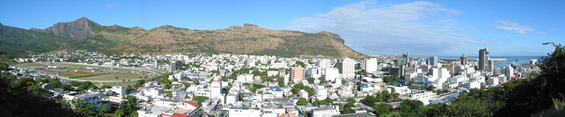 Panorama view of Port Louis. - Image by: Oscar Leo |
| To find a location type: street or place, city, optional: state, country. | Local Time Mauritius:
Saturday-June-27 10:44
UTC/GMT +4 hours |
One World - Nations Online .:. let's care for this planet Promote that every nation assumes responsibility for our world. Nations Online Project is made to improve cross-cultural understanding and global awareness. More signal - less NOISE |
| Site Map
| Information Sources | Disclaimer | Copyright © 1998-2024:: nationsonline.org |

