Nations Online
All Countries in the World
Nations Online All Countries in the World | |
Home  |
___ Satellite View and Map of the City of Edinburgh (in Scots: Embra/E'nburrie), Scotland, UK |
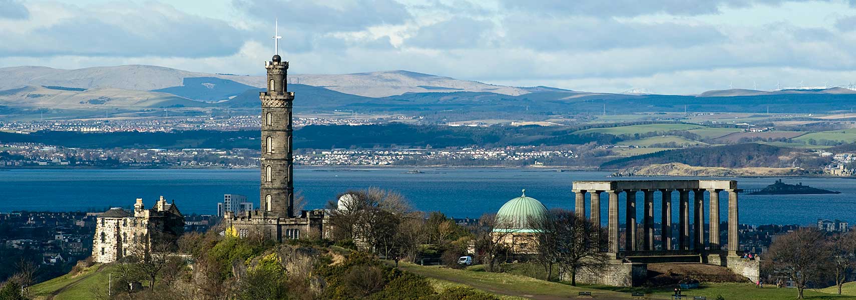 A view of Calton Hill from the Salisbury Crags, in background the Firth of Forth estuary. The monuments (from left to right) the Old Observatory House, the Nelson Monument (tower), the City Observatory (dome) and the National Monument of Scotland (unfinished facsimile of the Parthenon). Image: Saffron Blaze |
About Edinburgh Satellite View is showing Edinburgh, since 1437 the capital of Satellite View is showing Edinburgh, since 1437 the capital of The city is located in the Lothian region at the Firth of Forth, the estuary of the River Forth in south-east Scotland about 535 km (330 mi) northwest of London. For centuries the city is the center of Scotland. In the early 12th century David I, King of the Scots, established the town of Edinburgh as one of Scotland's earliest royal burghs (borough). Today Edinburgh has a population of about 498,000 inhabitants (in 2015 est.), more than 770,000 people live in the metropolitan area. In the UK's EU referendum on 23rd June 2016, Edinburgh voted 74.44% to remain. Scotland has voted to remain in the referendum by a majority of 62% to 38%. 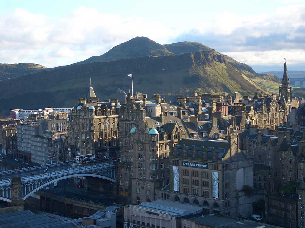 View of Edinburgh's Old Town from the Scott Monument. Arthur's Seat in background. Photo: Saskia van de Nieuwenhof The city boasts with cultural and historical attractions: the Edinburgh International Festival, the annual festival of performing arts; the National Museum of Scotland, and Scotland's art gallery, the Scottish National Gallery, and the Scottish National Gallery of Modern Art, with its collection of modern art. Edinburgh was named the world's first UNESCO City of Literature in 2004. Popular places to visit are the Edinburgh Castle, a historic fortress, and the Holyrood Palace, the official residence of the British monarch in Scotland. Royal Botanic Garden Edinburgh, a world-renowned scientific center for the study of plants. Historical places are the Edinburgh Vaults, the chambers in the arches of the South Bridge, Gladstone's Land, a 17th century high-tenement house, Lauriston Castle, a 16th-century tower and the Georgian House, an 18th-century townhouse. A must visit is the Old Town with Cockburn Street. The Map shows a city map of Edinburgh with expressways, main roads and streets, zoom out to find BAA Edinburgh (IATA code: EDI) 13 km (8 mi) by road in west from Edinburgh Old Town. Just zoom in to see St Giles' Cathedral, in the heart of the Old Town. To find a location use the form below. To view just the map, click on the "Map" button. |
|
| To find a location type: street or place, city, optional: state, country. |
Local Time Edinburgh:
Saturday-April-27 11:48
Standard time zone: No UTC/GMT offsetDaylight saving time (BST) in use from end of March until end of October, time zone offset: UTC/GMT +1 hours |
 |
||
One World - Nations Online .:. let's care for this planet Made to improve cross-cultural understanding, global awareness, and cultivating a cosmopolitan consciousness. |
 |
|
| Site Map
| Information Sources | Disclaimer: Privacy Policy, etc. | Contact:
[email protected]
Copyright © 1998-2017 :: nationsonline.org | ||

