Nations Online
All Countries in the World
Nations Online All Countries in the World | |
| Home |
___ Map of Cape Verde |
| Map is showing the islands of Cape Verde, the national capital Praia, municipality capitals, cities, main roads and the airport. Click on the map to enlarge. 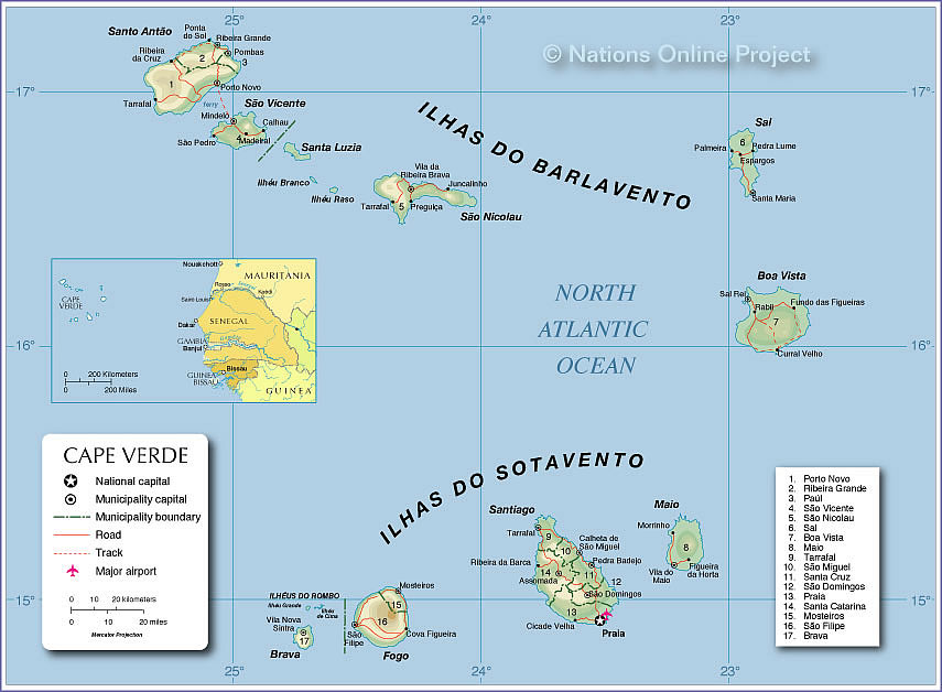 Map of Cape Verde |
||||||||||
| More about Cape Verde: Cities: Searchable map and satellite view of Cape Verde's capital city Country: Political Map of Cape Verde Map of Cape Verde showing the administrative divisions of Cape Verde. Continent: |
Weather Conditions Cape Verde
Weather Conditions São Vicente
|
Explore more:
Related Consumer Information:
|
||||||||
Searchable Maps of other Countries in West Africa: Benin | Burkina Faso | Cape Verde | Côte d'Ivoire | Ghana | Guinea | Guinea-Bissau Liberia | Mali | Mauritania | Niger | Nigeria | Senegal | Sierra Leone | Togo |
||||||||||
One World - Nations Online .:. let's care for this planet Made to improve cross-cultural understanding, global awareness, and cultivating a cosmopolitan consciousness. |
 |
|
| Site Map
| Information Sources | Disclaimer: Privacy Policy, etc. | Contact:
[email protected]
Copyright © 1998-2017 :: nationsonline.org | ||

