Advertising

Yemen Flag detail

Map of Yemen, Arabian Peninsula


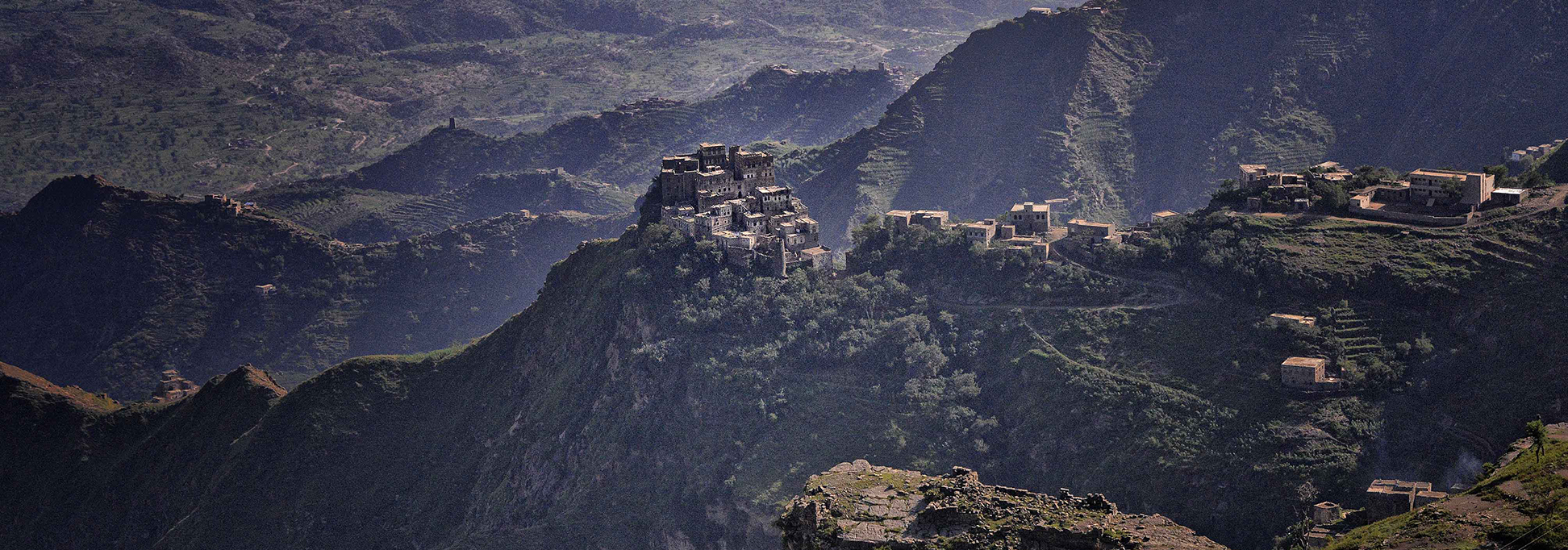
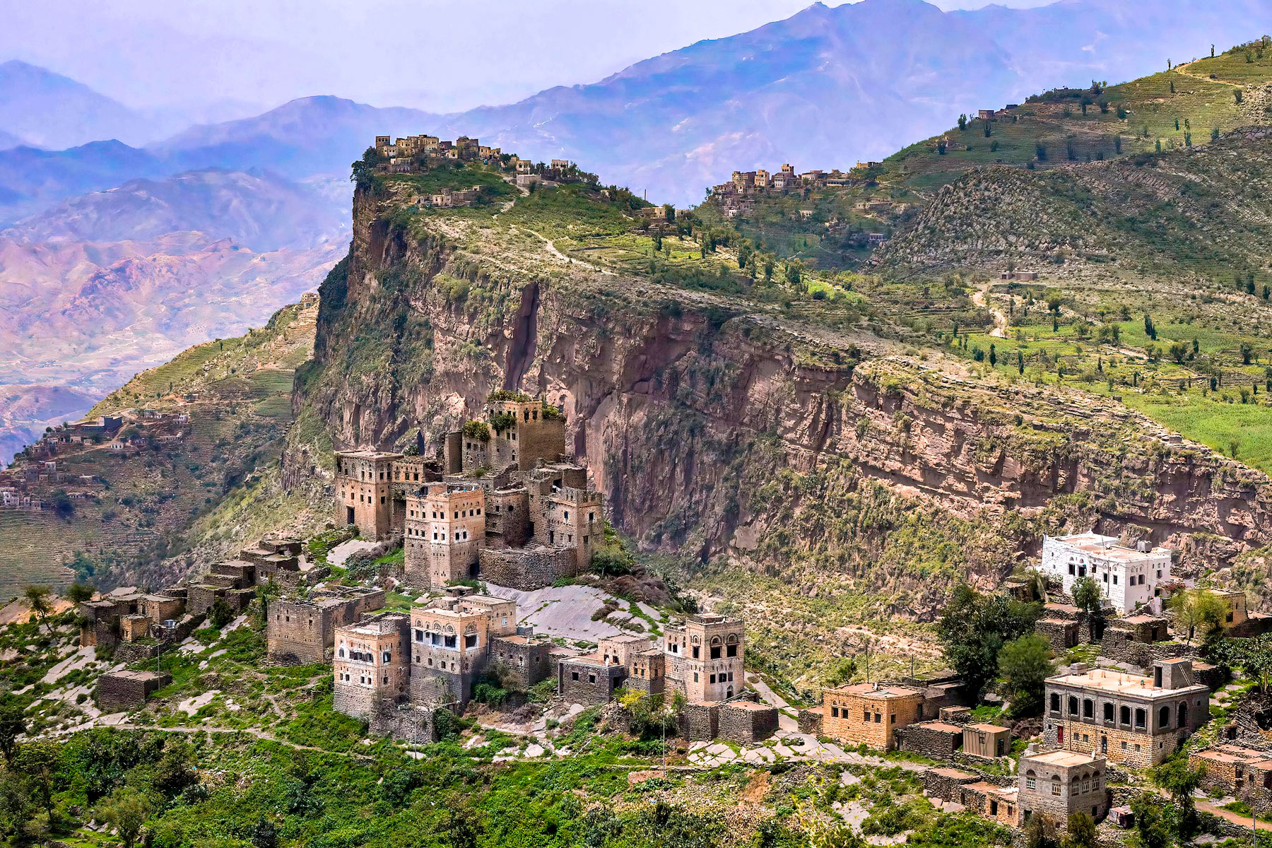
Terraced slopes and mountain settlements in the Haraz Mountains of western Yemen
Jabal Haraz, a mountainous region between Sana'a and the Red Sea port of Al Hudaydah, is known for its terraced slopes and fortified mountain villages.
Image: Rod Waddington

About Yemen
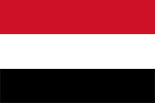

Yemen Flag
The map shows Yemen, a country of mountains, arid plateaus, deserts, and coastal plains in the Middle East, on the southwestern part of the Arabian Peninsula. The country is bounded in the west by the Red Sea, in the southwest by the Bab el Mandeb Strait, and in the south by the Gulf of Aden and the Arabian Sea. Yemen borders Saudi Arabia in the north and Oman in the east. The country also shares maritime borders with the African nations of Djibouti, Eritrea, and Somalia.

Area
Yemen occupies an area of approximately 527,968 km², including its islands, such as Socotra, Kamaran, and Perim (Mayyun). In comparison, it is slightly smaller than France or about twice the size of the US state of Wyoming.


Yemen's population is projected at about 43.0 million in 2026, based on the UN's World Population Prospects 2024 medium projection, as published by PopulationPyramid.net. For comparison, UNFPA reports 41.8 million for 2025. These are demographic estimates and projections, not a new census count.

Capital and government
Sana'a is Yemen's constitutional capital and largest city. Aden is the designated temporary capital of the internationally recognized government; Seiyun (Saywun) has not replaced it as the national capital. Yemen remains politically divided, with Houthi (Ansar Allah) de facto authorities in Sana'a. See the Yemen Permanent Mission to the United Nations and the UN Special Envoy for Yemen.

Language and religion
Arabic is the official language, and Yemeni Arabic varieties are widely spoken. Islam is the predominant religion. The principal traditions are Shafi'i Sunni Islam and Zaydi Shia Islam; Zaydi communities are concentrated in the northern highlands, while Sunni communities are widespread in the south and coastal areas. This broad pattern does not imply that regions are religiously uniform. Religious background.
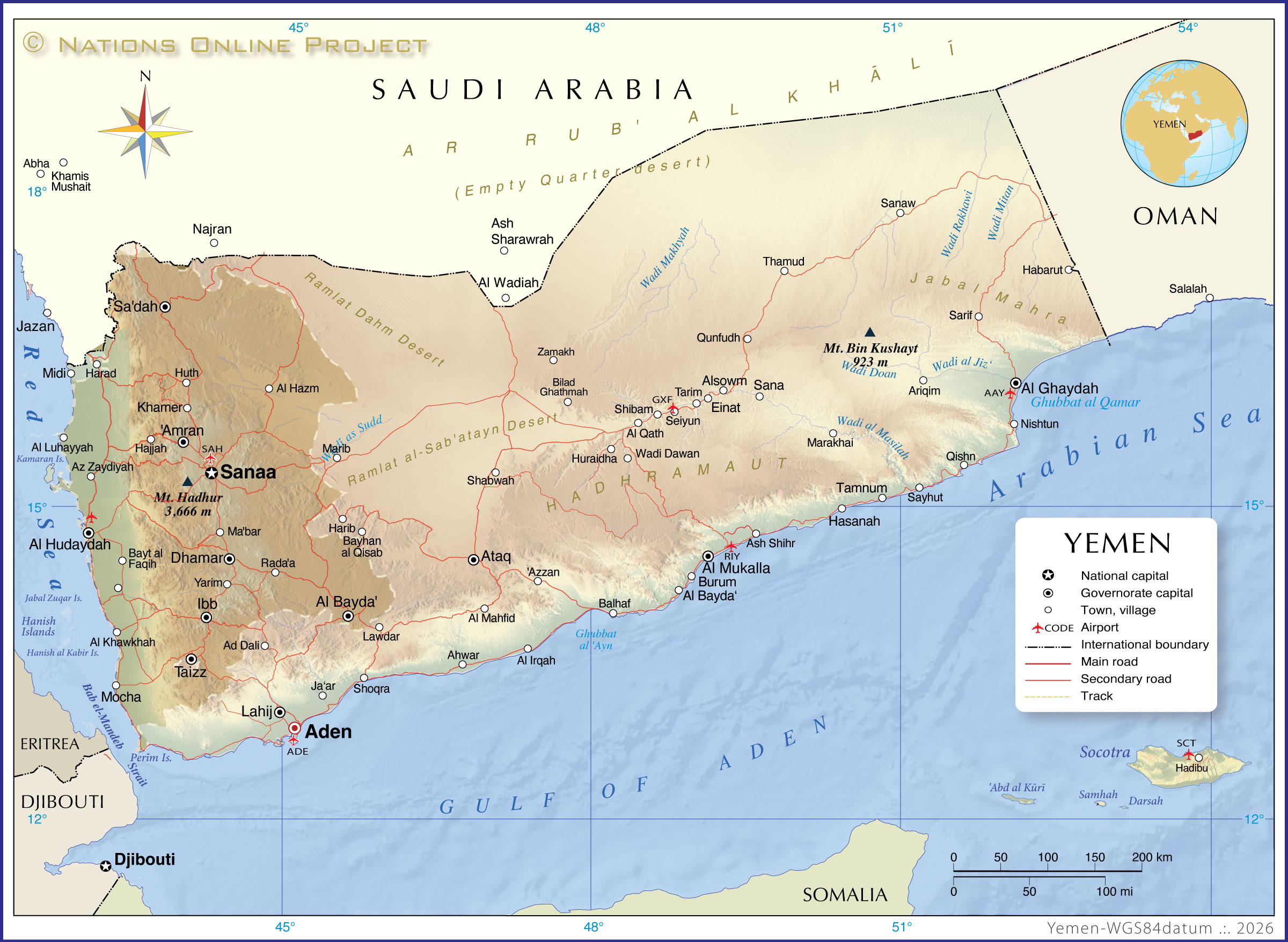
Map of Yemen

Yemen map with major cities and roads. Political Map of Yemen

The map shows a topgraphic Yemen and surrounding countries with international borders, the national capital Sana'a, governorate capitals, major cities, main roads, tracks, and airports.
The map shows the Houthi rebel occupied area in the west, which includes most of the country's western coast. Following recent 2026 developments, the group has fought over and moved across parts of the Red Sea coast and the strategic Bab al-Mandeb Strait area, though active Saudi-backed and government counteroffensives are currently contesting these coastal and southern zones (such as around Dhubab and Mocha).

You are free to use the above map for educational and similar purposes; if you publish it online or in print, you need to credit the Nations Online Project as the source.
 

More about Yemen


Yemen Conflict & War

Updated 12 October 2026

In recent days, Yemen's Iran-backed Houthi rebels have launched a major escalation of missile, drone, and ballistic attacks targeting Saudi Arabian airports and infrastructure, including consecutive strikes on Riyadh's King Khalid International Airport that killed at least several people and wounded over 300 others.

Renewed fighting and threats to Red Sea shipping Yemen's conflict has intensified again, with renewed fighting between Houthi forces, also known as Ansar Allah, and forces supporting the internationally recognized government. The escalation threatens efforts to reach a political settlement after more than a decade of war. On 7 September, UN Special Envoy Hans Grundberg called for an end to hostilities, warning of mounting civilian casualties, displacement, and damage to infrastructure.
| UN Special Envoy for Yemen |


The southern Red Sea coast has become a focus of the fighting. On 11 September, the Associated Press reported that Houthi forces had seized the island of Mayun, also called Perim, following their capture of the port of Mokha. Mayun lies in the Bab el Mandeb Strait, which connects the Red Sea with the Gulf of Aden. These advances increase the threat to commercial shipping along a route linking the Indian Ocean with the Suez Canal.
| Associated Press |

The humanitarian consequences are already substantial. According to UNFPA, fighting that intensified in Taiz Governorate on 3 September spread to the west coast by 5 September. Nearly 40,000 people had fled their homes by 7 September. Shelling, insecurity, and telecommunications disruptions have hindered relief operations and access to essential health care. [UNFPA emergency update](https://www.unfpa.org/resources/flash-update-hostilities-yemen-3-8-september-2026) This new displacement adds to an existing nationwide emergency. In its April–June 2026 report, UNFPA estimated that more than 22 million people needed humanitarian assistance and protection services. Food insecurity, funding shortages, and weakened health services continue to compound the effects of conflict. [UNFPA situation report](https://www.unfpa.org/resources/situation-report-crisis-yemen-april-june-2026)


Who are the Houthis


The Houthis, officially known as Ansar Allah (Partisans of God), are a Zaydi Shia political and military movement based in Yemen.
The group emerged in northern Yemen's Saada province in the 1990s, founded by Hussein Badreddin al-Houthi as a Zaydi revivalist movement to protect the Zaydi Shia minority and oppose foreign influence. They align with Khomeinism, Zaydi Islamism, and anti-imperialism, and consider themselves part of the Iran-led "Axis of Resistance" alongside groups like Hamas and Hezbollah.


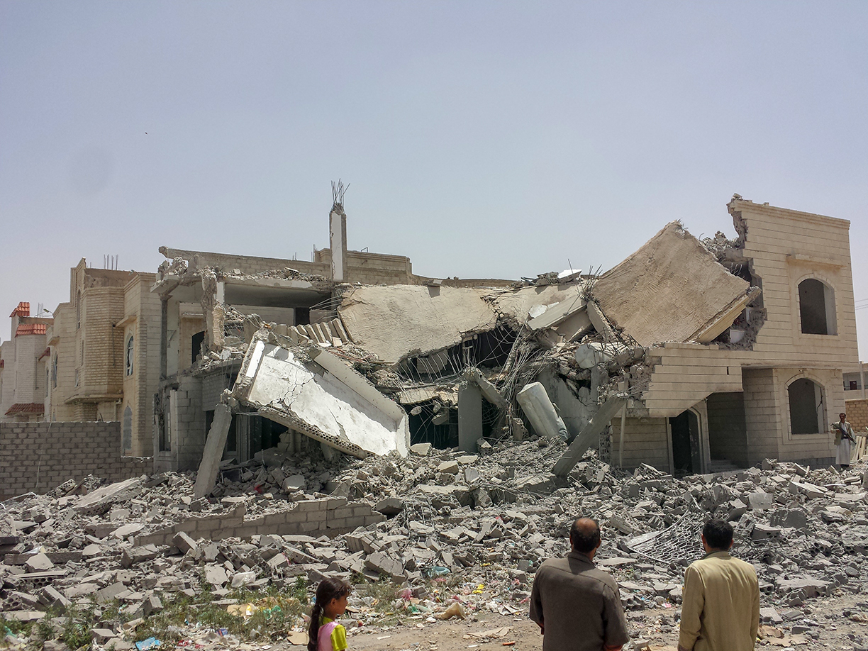
A house in Sana'a destroyed during the conflict in June 2015.
Photo: Ibrahem Qasim


Geography of Yemen


Coastal plain

Tihamah
The Tihamah is the hot, low-lying coastal plain between the Red Sea and Yemen's western mountains. Rainfall is generally low, but runoff from the highlands supports farming along wadis.


Mountains

Western Highlands
In the west, the rugged terrain of the Western Highlands and their foothills dominates the country. The relatively fertile highlands form the southern part of the Sarawat Mountains, the mountain belt extending through western Saudi Arabia and Yemen.
Situated within the highlands is Jabal Haraz, a mountainous region west of the country's capital, Sana'a. The Haraz region is famous for its dramatic topography, terraced landscapes, and historic villages. West of Sana'a, Jabal An-Nabi Shu'ayb rises to about 3,666 m (12,028 ft), the highest point in Yemen and the Arabian Peninsula.

A mountain village perched on a ridge in the Haraz Mountains of Yemen
A mountain village in Yemen's Haraz Mountains.
Photo: Rod Waddington

Central Highlands
Inland from the western escarpment, high plateaus and basins are interspersed with hills and prominent peaks. Conditions generally become drier toward the east. Terraced cultivation and farming in valleys depend on variable seasonal rainfall and groundwater.

Mahra Mountains
In eastern Yemen, the mountains and plateaus of Al Mahrah extend toward the border with Oman. Near Hawf, seasonal monsoon moisture supports woodland, an exception to the generally arid surroundings. UNESCO: The Hawf Area.


Desert
Rub' al-Khali
The Rub' al-Khali, or Empty Quarter, extends into northeastern Yemen. It is one of the world's largest sand deserts. Ramlat al-Sab'atayn is another extensive desert in the interior, east of the western highlands.


Rivers
Yemen has no major perennial rivers. Most surface flow occurs in wadis after rainfall.


Wadis
Wadis are valleys or channels that carry water intermittently, often as flash floods after heavy rain. Yemen's main rainy periods occur in spring and summer, with large regional differences; wadis do not simply dry up every summer. FAO: Yemen country profile.

Wadi Hadhramaut (Hadramawt) is a major valley system in the eastern interior. Its settlements and agriculture depend heavily on groundwater and occasional floodwater. Its drainage continues toward the Arabian Sea through Wadi Masilah.


See also: Topographic Map of Yemen


The map shows cities and towns in Yemen and neighboring countries:

Ad Dali, Aden (Adan), Ahwar, Al Bayda, Al Fardah, Al Ghaydah, Al Hajar, Al Hazm, Al Hudaydah, Al Huraydah, Al Huwaymi, Al Irqah, Al Mukalla, Al Mukha, Al Wudaiah, Amran, Ariqim, As Surrah, Ash Shihr, Ataq, Aynat, Azzan, Az Zaydiyah, Balhaf, Bayhan al Qisab, Bayt al Faqih, Burum, Dhamar, Faghmah, Ghayl Ba Wazir, Habarut, Hajjah, Harib, Hasanah, Hawra, Hayjan, Haynin, Hisn al Abr, Huth, Ibb, Khamr, Lahij, Lawdar, Luyah, Al Mabar, Marib, Madinat ash Shab, Manakhah, Marakhayy, Masnaah, Mawshij, Maydi, Mayfa'ah, Nisab, Nishtun, Nuqub, Qadub, Qishn, Rida, Sadah, Salasil, Sana'a (San'a'), Sana', Sanaw, Sarif, Sayhut, Saywun, Shabwah, Shaqra, Shaykh Uthman, Taiz, Tamnum, Tarim, Thamud, Yarim, Yashbum, Zabid, Zamakhand, and Zinjibar.

Places shown in Saudi Arabia: Abha, Jizan, Khamis Mushayt, Najran, Al Qunfudhah (Qunfudh), and Sharurah.
Transliterations vary; this index largely follows the labels on the original map.
 

Advertisements:


Weather in Sana'a:

SANA'A WEATHER
 

Advertisements:


Political Maps of other Countries in the Middle East:
Bahrain Map, Cyprus Map, Egypt Map, Iran Map, Iraq Map, Israel Map, Jordan Map, Kuwait Map, Lebanon Map, Oman Map, Qatar Map, Saudi Arabia Map, Syria Map, Turkey Map, United Arab Emirates Map, Yemen Map